Weather?Most people, if they want to know what the weather is like, they'll look out the window, or turn on the television.
For us geeks this won't do.
If I remember correctly, there was a discussion on DC about weather programs or even a review, I can't remember, I may have mentioned xastir in there, but I'd really like to start a thread dedicated to this fine piece of software, because I have been able to use it in so many different ways, and it goes quite beyond just weather.
Radio? GPS?Xastir is APRS software aimed towards ham radio operators, search and rescue teams, and weather spotters.
APRS (
http://en.wikipedia.org/wiki/APRS) is a position reporting system that runs on top of the ax.25 protocol (
http://en.wikipedia.org/wiki/AX.25), which is an amateur radio version of the x.25 (
http://en.wikipedia.org/wiki/X.25) protocol. Initially, the way this worked, was a station (radio transmitter) is hooked up to a little modem which is in turn hooked up to a GPS receiver. The modem would translate the GPS signal to APRS AX.25 packets and send them to the radio as Packet Radio FSK (
http://en.wikipedia....rg/wiki/Packet_radio). Later the modems were more commonly replaced with laptops or desktop computers.
InternetNowerdays you don't even need a radio anymore to use APRS. Ever since the Internet came about, radio amateurs have started to make 'bridges' between radio and the internet. There are many internet APRS servers out there that mirror all packets received from local radios, relays and other internet servers. Some of them are dedicated to emergency services or weather data.
Additional dataOver the years, lots of additional data has found it's way into APRS packets next to the position reporting. There is weather data, graphical icons and objects, polygons, bbs-style messaging, email and much more.
SpaceThere are a few satellites equipped with APRS relay systems. The International Space Station also has an APRS relay/bbs onboard. Check out
http://www.amsat.org for more info about APRS in space.
MapsXastir can display tigermaps (
http://tiger.census....i-bin/mapbrowse-tbl/) automatically downloaded from the internet and shows the aprs icons on top of it, it is also capable of layering different maps on top of eachother such as Live weather radar maps, satelite images like google earth, bitmaps, and much more... All in all, xastir supports 125 map formats.
Additional features - Can show a trail tracking a target.
- Can show a halo/circle around an object with the diameter representing signal strength
- Layers
- It has special weather and satellite modes.
- ...
Practical uses- Obiously, you can use it to check the position of anyone with an APRS system connected to either the internet or a radio (if you have a ham license). And display it on a pretty map as a little car icon or a little walking guy, or whatever.
- You can also use it to check the weather, areas with weather warnings may have a line around them or some other object, while you can set all regular weather stations to show the temperatures on the map, etc...
- But you can get very creative with it too. I wrote a flight simulator 2004 plugin once that would translate my airplane's position to APRS packets and send them over LAN to my other computer, showing my plane position on a xastir map. If I would stand on a runway in the game, I could see it very accurately on a runway in Xastir on a satellite map. I had awesome screenshots of that, but they got lost in a hd format

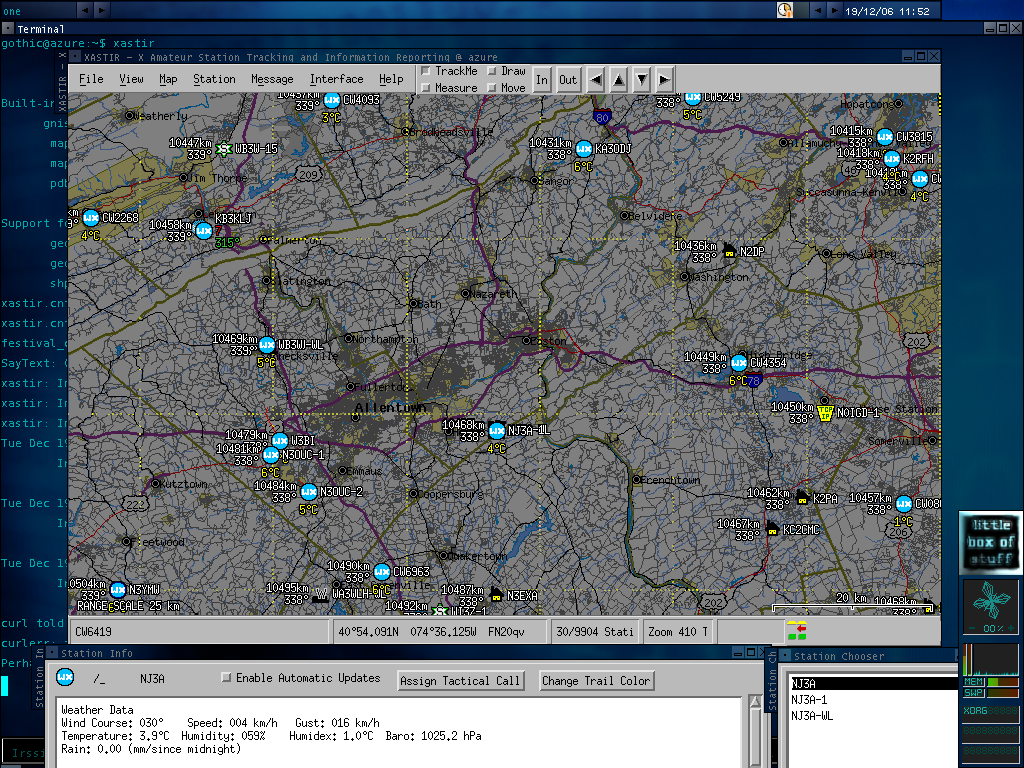
Anyway, here's a screenshot of the weather around here today


To use xastir you can just connect to an internet APRS server, you don't need anything else.
List of APRS servers:
http://www.aprs-is.net/APRSServers.htmTo connect, just click Interface->Interface control->Add->Internet server
Make sure to enter the right port number, if you click on a server on that APRS server list, it will typically have it's own page showing the correct port number.
Xastir website:
http://www.xastir.org/
