
4651
General Software Discussion / Re: need to scan a map and then color it
« on: October 12, 2010, 11:07 PM »
If you want just an outline map showing the county lines you might like to check out the Libre Map Project, (USA State map link), it might save you the trouble of scanning.
I haven't fully explored the site but it may have more detailed maps showing things like cities, rivers, etc.
Or, using a scan of a state map, you should be able to overlay the state/county maps from Libre Maps to give you your lines.
You'll need an SVG viewer, Adobe has one that incorporates into IE, download it here.
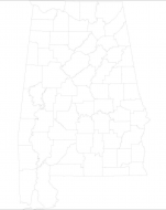
You'll probably need to beef up the contrast on them. The above is a county map, (Alabama IIRC), but there's also sub-county which might have more detail.
I haven't fully explored the site but it may have more detailed maps showing things like cities, rivers, etc.
Or, using a scan of a state map, you should be able to overlay the state/county maps from Libre Maps to give you your lines.
You'll need an SVG viewer, Adobe has one that incorporates into IE, download it here.
You'll probably need to beef up the contrast on them. The above is a county map, (Alabama IIRC), but there's also sub-county which might have more detail.


